文章目錄
- 0.引言
- 1.加載底圖
- 2.獲取點要素的坐標
- 3.添加含圖片樣式的幾何要素
- 4.完整實現
0.引言
ArcGIS API for JavaScript 是一個用于在Web和移動應用程序中創建交互式地圖和地理空間分析應用的庫。本文在ArcGIS For JavaScript中使用Graphic對象來創建包含圖片樣式的點要素。
1.加載底圖
(1)實現代碼
<!DOCTYPE html>
<html>  <head>  <meta http-equiv="Content-Type" content="text/html; charset=utf-8" />  <title>Create Map</title>  <link rel="stylesheet" href="http://localhost:8099/arcgis_js_api/javascript/4.28/esri/themes/light/main.css" />  <script src="http://localhost:8099/arcgis_js_api/javascript/4.28/init.js"></script>  <style>  html,  body,  #viewDiv {  padding: 0;  margin: 0;  height: 100%;  width: 100%;  }  </style>  <script type="text/javascript">  require(["esri/Map",  "esri/Basemap",  "esri/layers/TileLayer",  "esri/views/MapView",  "esri/layers/GraphicsLayer",  "esri/Graphic"  ], (  Map,  Basemap,  TileLayer,  MapView,  GraphicsLayer,  Graphic  )=>{  //添加底圖  var lyTile = new TileLayer({  url:"http://map.geoq.cn/ArcGIS/rest/services/ChinaOnlineStreetPurplishBlue/MapServer"  });  var baseMap = new Basemap({  baseLayers: [lyTile]  });  var map = new Map({  basemap: baseMap  });  var view = new MapView({  container: "viewDiv",  map: map,  zoom: 16,  center: [106.56657791438427, 29.679927608558902]  });  });  </script>
</head>  <body>  <div id="viewDiv"></div>
</body>  </html>
(2)實現結果
??
2.獲取點要素的坐標
(1)實現代碼
??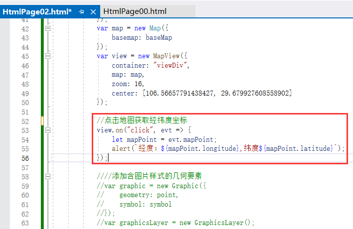
//點擊地圖獲取經緯度坐標
view.on("click", evt => {  let mapPoint = evt.mapPoint;  alert(`經度:${mapPoint.longitude},緯度${mapPoint.latitude}`);
});
(2)實現結果
??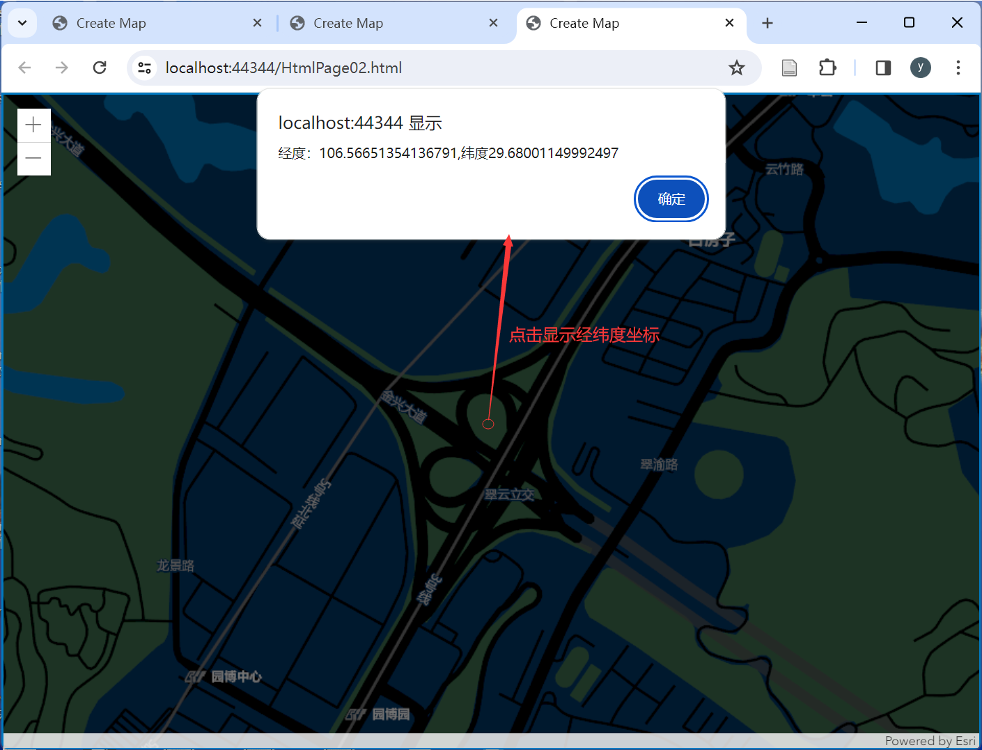
以上獲取的坐標作為點要素的坐標,為(經度:106.56651354136791,緯度29.68001149992497)。
3.添加含圖片樣式的幾何要素
(1)實現代碼
??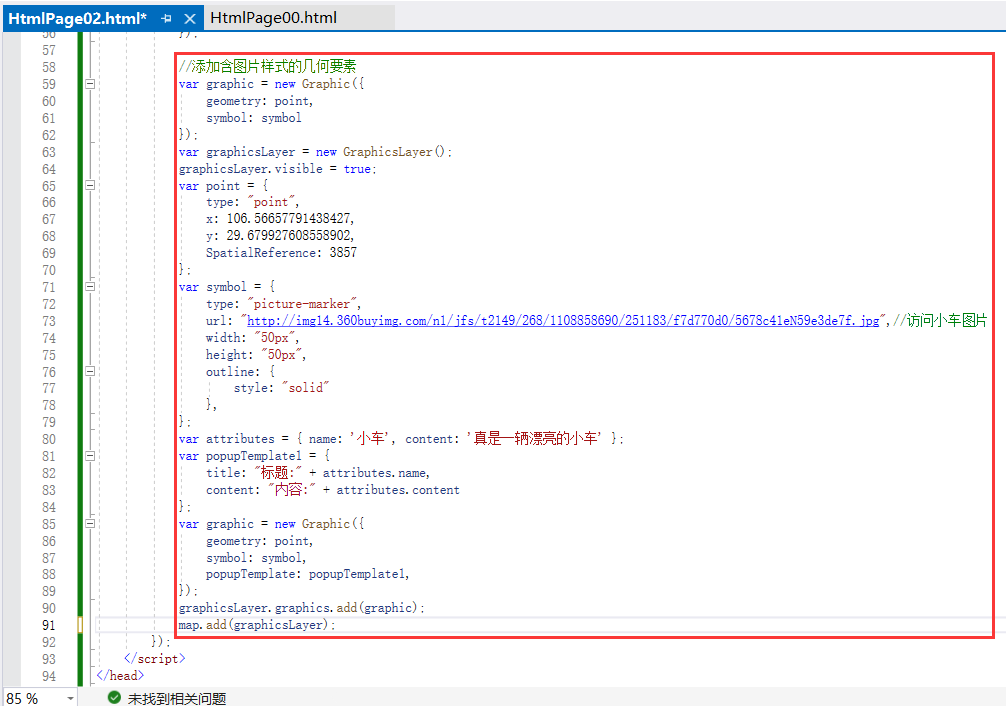
//添加含圖片樣式的幾何要素
var graphic = new Graphic({ geometry: point, symbol: symbol
});
var graphicsLayer = new GraphicsLayer();
graphicsLayer.visible = true;
var point = { type: "point", x: 106.56657791438427, y: 29.679927608558902, SpatialReference: 3857
};
var symbol = { type: "picture-marker", url:"http://img14.360buyimg.com/n1/jfs/t2149/268/1108858690/251183/f7d770d0/5678c41eN59e3de7f.jpg",//訪問小車圖片 width: "50px", height: "50px", outline: { style: "solid" },
};
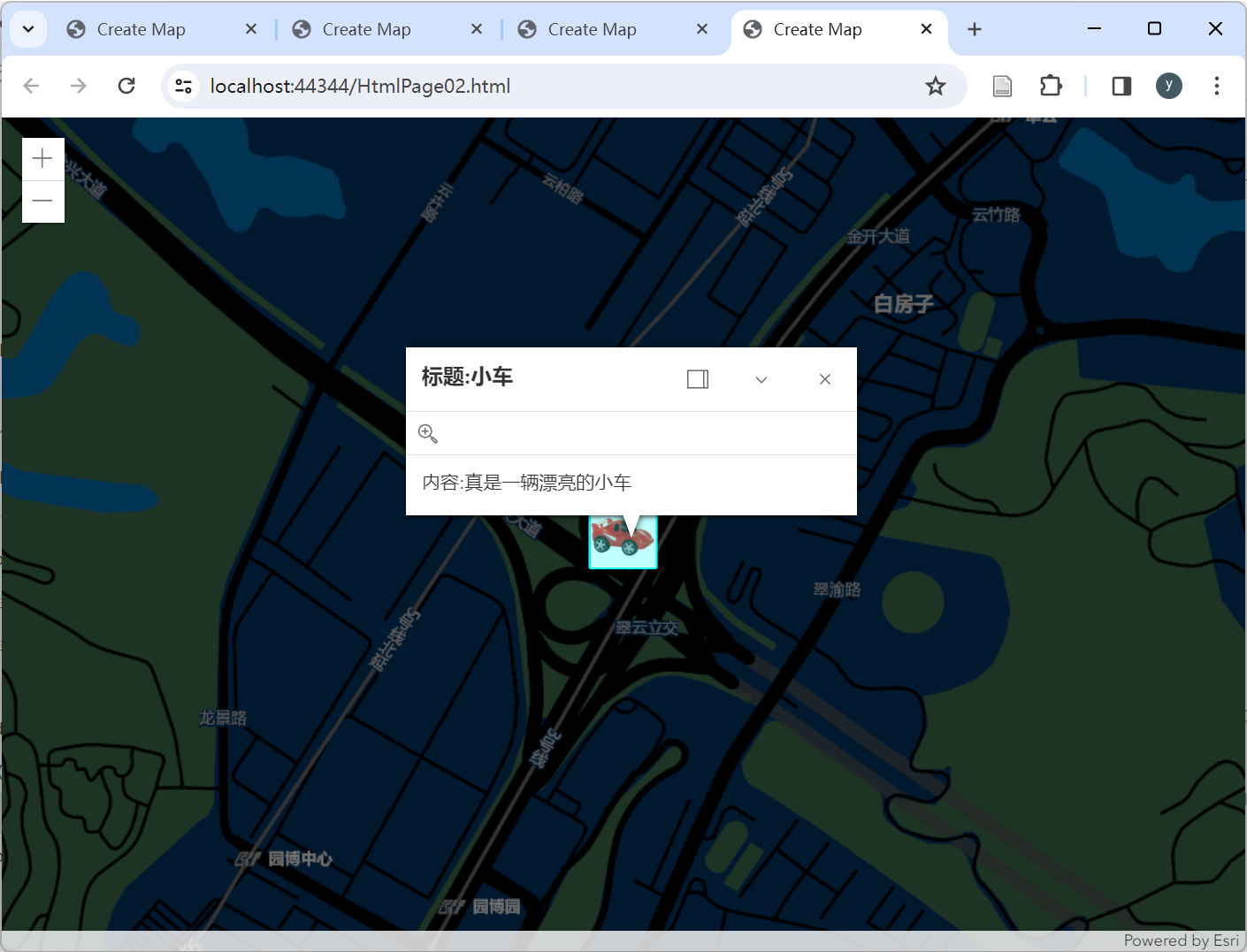
var attributes = { name: '小車', content: '真是一輛漂亮的小車' };
var popupTemplate1 = { title: "標題:" + attributes.name, content: "內容:" + attributes.content
};
var graphic = new Graphic({ geometry: point, symbol: symbol, popupTemplate: popupTemplate1,
});
graphicsLayer.graphics.add(graphic);
map.add(graphicsLayer);
(2)實現結果
??
4.完整實現
(1)完整代碼
<!DOCTYPE html>
<html>  <head>  <meta http-equiv="Content-Type" content="text/html; charset=utf-8" />  <title>Create Map</title>  <link rel="stylesheet" href="http://localhost:8099/arcgis_js_api/javascript/4.28/esri/themes/light/main.css" />  <script src="http://localhost:8099/arcgis_js_api/javascript/4.28/init.js"></script>  <style>  html,  body,  #viewDiv {  padding: 0;  margin: 0;  height: 100%;  width: 100%;  }  </style>  <script type="text/javascript">  require(["esri/Map",  "esri/Basemap",  "esri/layers/TileLayer",  "esri/views/MapView",  "esri/layers/GraphicsLayer",  "esri/Graphic"  ], (  Map,  Basemap,  TileLayer,  MapView,  GraphicsLayer,  Graphic  )=>{  //添加底圖  var lyTile = new TileLayer({  url:"http://map.geoq.cn/ArcGIS/rest/services/ChinaOnlineStreetPurplishBlue/MapServer"  });  var graphic = new Graphic({  geometry: point,  symbol: symbol  });  //創建一個圖層  var graphicsLayer = new GraphicsLayer();  //設置可見  graphicsLayer.visible = true;  //創建一個面  var point = {  type: "point",  x: 106.56657791438427,  y: 29.679927608558902,  SpatialReference: 3857  };  var symbol = {  type: "picture-marker",  url:"http://img14.360buyimg.com/n1/jfs/t2149/268/1108858690/251183/f7d770d0/5678c41eN59e3de7f.jpg",//訪問小車圖片  width: "50px",  height: "50px",  outline: {  style: "solid"  },  };  var attributes = { name: '小車', content: '真是一輛漂亮的小車' };  var popupTemplate1 = {  title: "標題:" + attributes.name,  content: "內容:" + attributes.content  };  var graphic = new Graphic({  geometry: point,  symbol: symbol,  popupTemplate: popupTemplate1,  });  graphicsLayer.graphics.add(graphic);  var baseMap = new Basemap({  baseLayers: [lyTile]  });  var map = new Map({  basemap: baseMap  });  map.add(graphicsLayer)  var view = new MapView({  container: "viewDiv", // Reference to the DOM node that will contain the view  map: map, // References the map object created in step 3  zoom: 16,  center: [106.56657791438427, 29.679927608558902]  });  //點擊地圖獲取經緯度坐標  //view.on("click", evt => {  //    let mapPoint = evt.mapPoint;  //    alert(`經度:${mapPoint.longitude},緯度${mapPoint.latitude}`);  //});  });  </script>
</head>  <body>  <div id="viewDiv"></div>
</body>  </html>
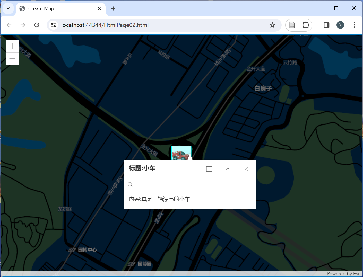
(2)實現結果
??
參考資料:
[1] 一入GIS深似海. 不一樣的前端,JavaScript之arcgis api教程; 2020-11-02 [accessed 2024-02-22].
[2] 半個GIS半個前端. arcgis api(三)arcgis api for js 4.x 加載高德地圖、谷歌地圖、天地圖; 2018-08-17 [accessed 2024-02-22].
[3] 前端三腳貓. js中的變量聲明(var、let、const的區別和解析); 2021-03-08 [accessed 2024-02-22].


利用腳本進行區塊鏈系統監控)


之SpringCloud Gateway)
 Object Pascal 學習筆記---第5章第3節(自定義托管記錄))


】AkkaRpcActor設計與實現:接收RPC消息以及處理邏輯)
