效果圖:
實現代碼:
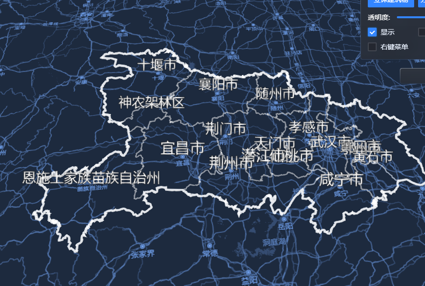
export function showChinaLine() {map.basemap = 2017graphicLayer = new mars3d.layer.GeoJsonLayer({name: "全國省界",url: "https://data.mars3d.cn/file/geojson/areas/420000_full.json",format: simplifyGeoJSON,symbol: {type: "polylineP",styleOptions: {width: 2,color: "rgba(255,255,255,0.3) ",label: {text: "{name}",position: "{center}", // 省會位置centerfont_size: 30,color: "#ffffff",outline: true,outlineColor: "#000000",scaleByDistance: true,scaleByDistance_far: 60000000,scaleByDistance_farValue: 0.2,scaleByDistance_near: 1000000,scaleByDistance_nearValue: 1,distanceDisplayCondition: true,distanceDisplayCondition_far: 10000000,distanceDisplayCondition_near: 100000,setHeight: 10000}}},flyTo: true})map.addLayer(graphicLayer)const graphic = new mars3d.layer.GeoJsonLayer({name: "全國省界",url: "https://data.mars3d.cn/file/geojson/areas/420000.json",format: simplifyGeoJSON,symbol: {type: "polyline",styleOptions: {color: "rgba(255,255,255,0.3)",width: 4,opacity: 0.8,}},flyTo: true})map.addLayer(graphic)}對應鏈接:
功能示例(Vue版) | Mars3D三維可視化平臺 | 火星科技?

![[echart] Vue3中使用Echart時圖表不渲染](http://pic.xiahunao.cn/[echart] Vue3中使用Echart時圖表不渲染)


)

棧和隊列算法題 OVA)


算法深度剖析:動態環境下的路徑規劃革新)